See the Precise Extent of Your Property Registration
We check land registry folios using GPS and accurately overlay them with aerial photography, which may be of particular interest if you are one of the following:
- Land owner
- Solicitor
- Property Manager
- Land/Site Purchaser
Mapping services for
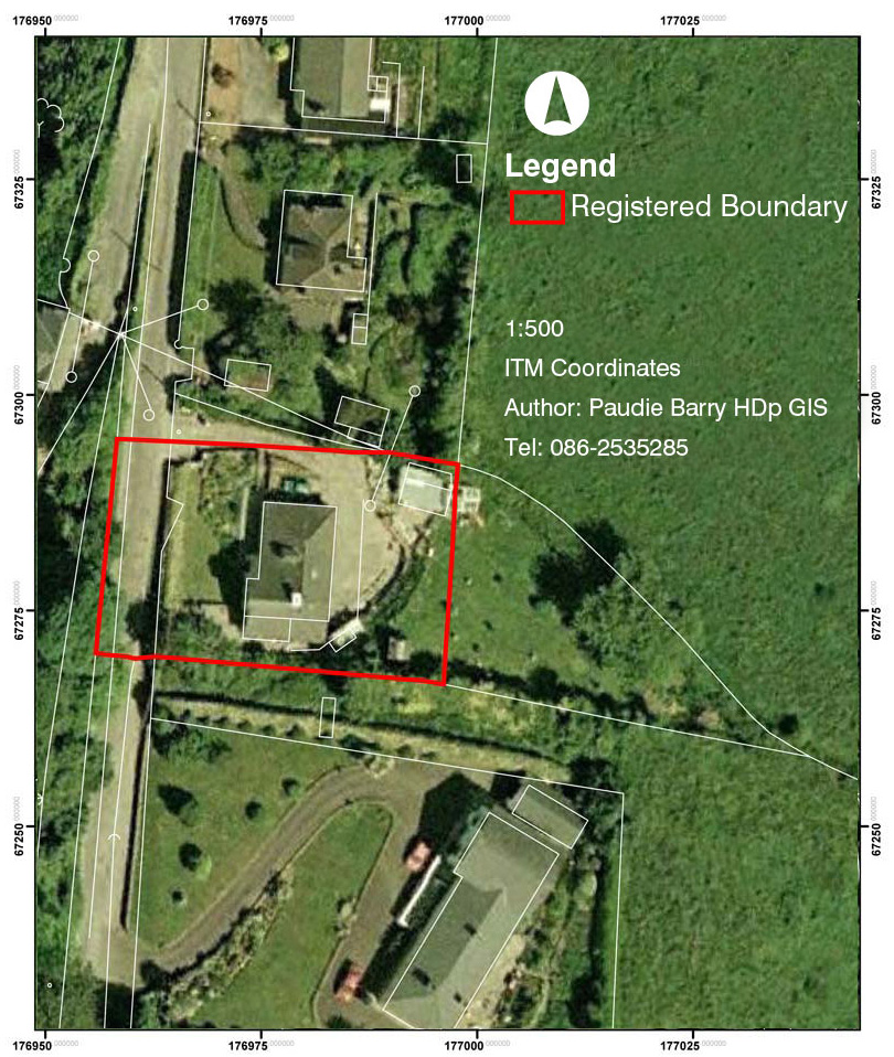
Orthophoto - Registered Property Overlay

Advantages:
- Highlights errors in property registration
- Clearly illustrates accurate position of registered ownership on the ground
- Mathematical overlay carried out by Irelands leading boundary mapping expert
- Can quickly rectify any errors with Land Registry
Aerial photography is geo referenced to ITM coordinates to within 25mm, using survey grade GPS.